Grand Valley River Corridor
Master Plan
The Colorado River—and its connection with the Gunnison—shapes the land, communities, and way of life across the Grand Valley. The river nourishes our farms and ranches, supports local businesses, provides habitat for wildlife, and offers endless opportunities for recreation and gathering.
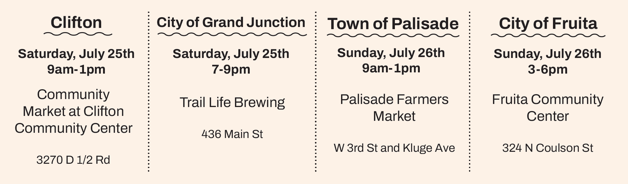
We are coming to your community this summer!
Join us and share feedback on the draft plan!
WHY A MASTER PLAN?
The Grand Valley River Corridor Master Plan is a shared vision for the river’s future—a roadmap that will guide stewardship, investment, and growth while respecting local control over zoning and development. It will outline strategies for recreation, natural resource protection, land use, and education to ensure the river remains both a treasured community asset and a resilient natural resource.
The Master Plan is about good stewardship: preserving what makes the valley strong, while creating new opportunities for access, recreation, and economic vitality. At every step, local voices and community values will remain central to the process.

The Master Planning Process is a 15-month, collaborative and data-driven process. The project kicked off in Fall 2025, and is planned to wrap up in late Summer/early Fall 2026.
Planning Background:
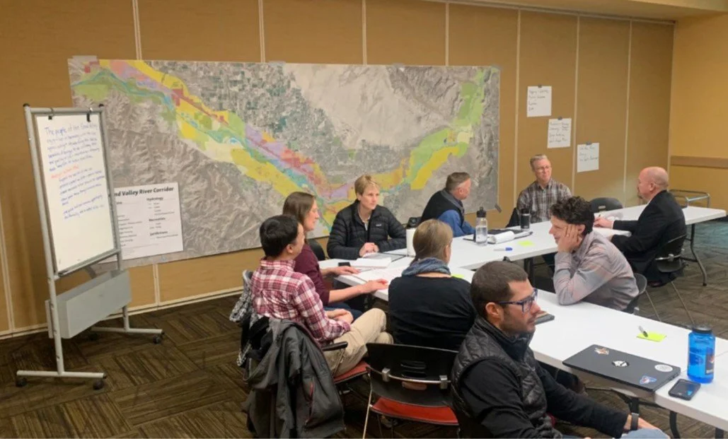
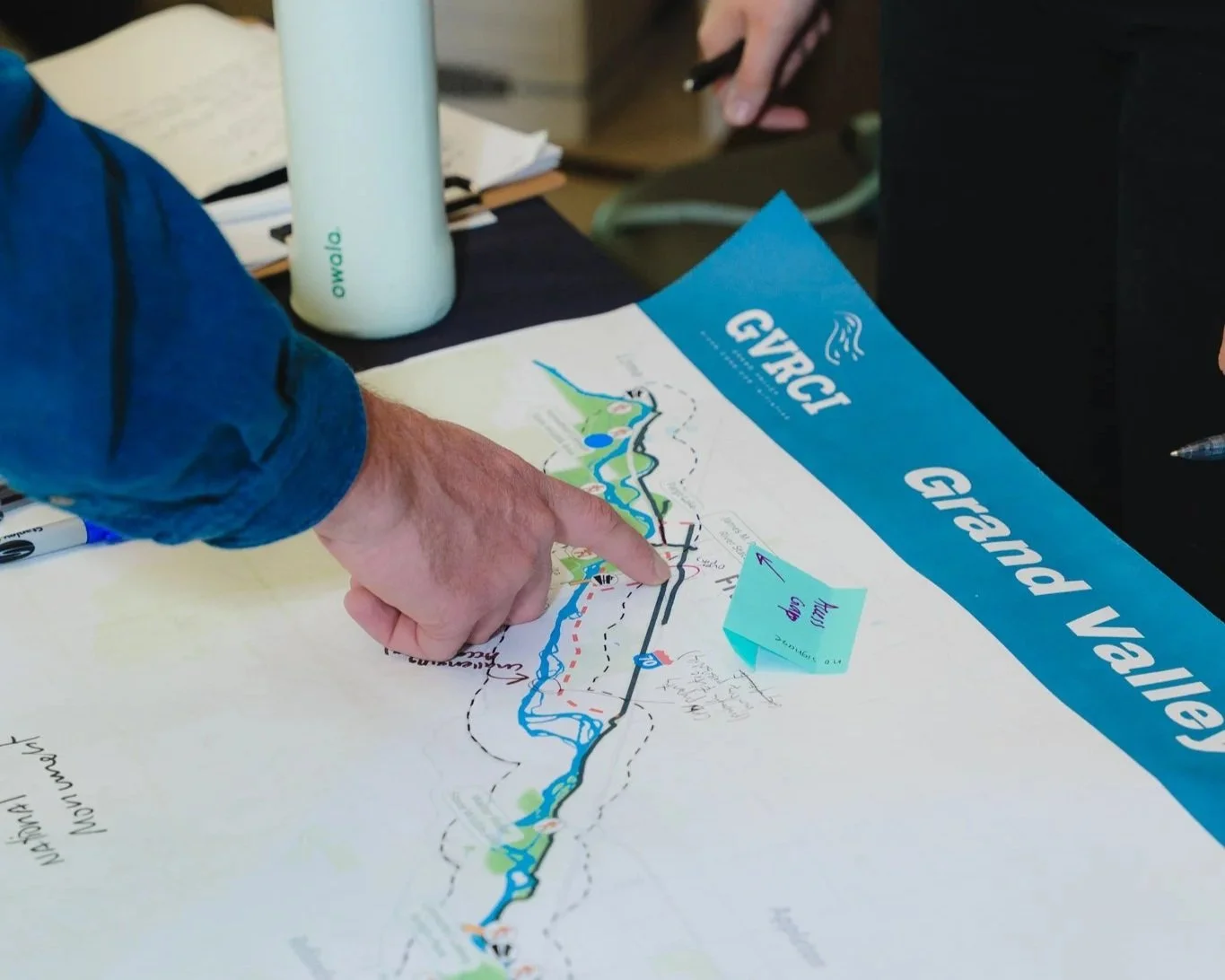
The Town of Palisade, City of Grand Junction, City of Fruita, and Mesa County came together in late 2023 to collaborate on a river Planning Framework and agreement on next steps for the river corridor.
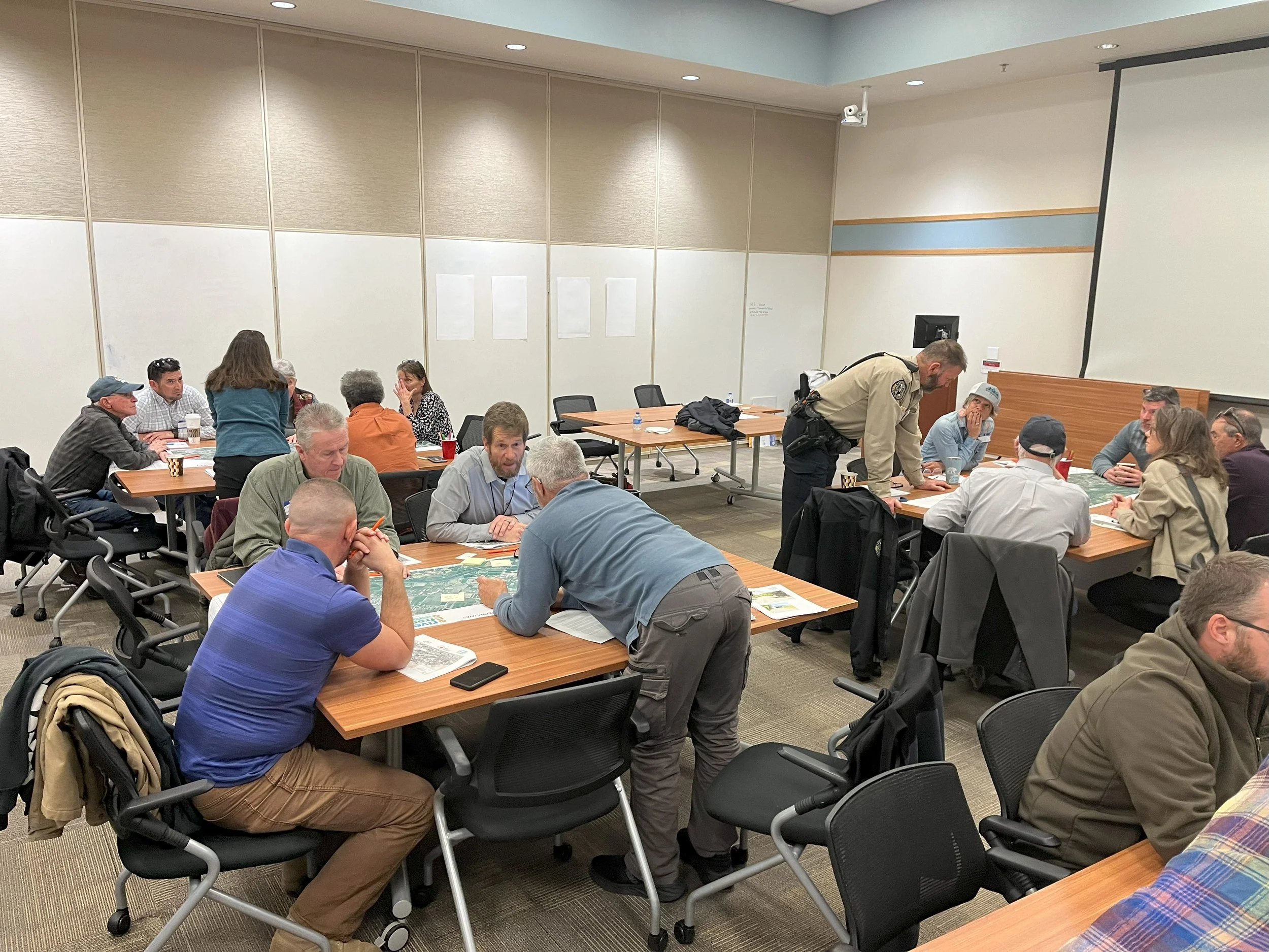
For months, representatives from across the valley worked together to identify challenges, assets, and community values, learn from peer city examples, and confirm the principles that will guide the future of the river corridor. The group focused on the guiding question: Where do we want to be in 20-30 years?
The Planning Framework process concluded with Memorandums of Understanding among the jurisdictions to support the development of a Master Plan for the Grand Valley River Corridor. The effort was successfully funded through state grants with support from the jurisdictions.
Vision
The communities of the Grand Valley are committed to a data-driven approach to steward a resilient, vibrant, and healthy river corridor that supports agriculture, habitat and wildlife, recreation, economic growth and sustainable development benefiting today and future generations.
The Grand Valley River Vision was reviewed and finalized by the GVRCI Advisory Council
Goals
The goals of this Master Plan have been shaped by the community, jurisdictional representatives, and the Core Team of GVRCI.
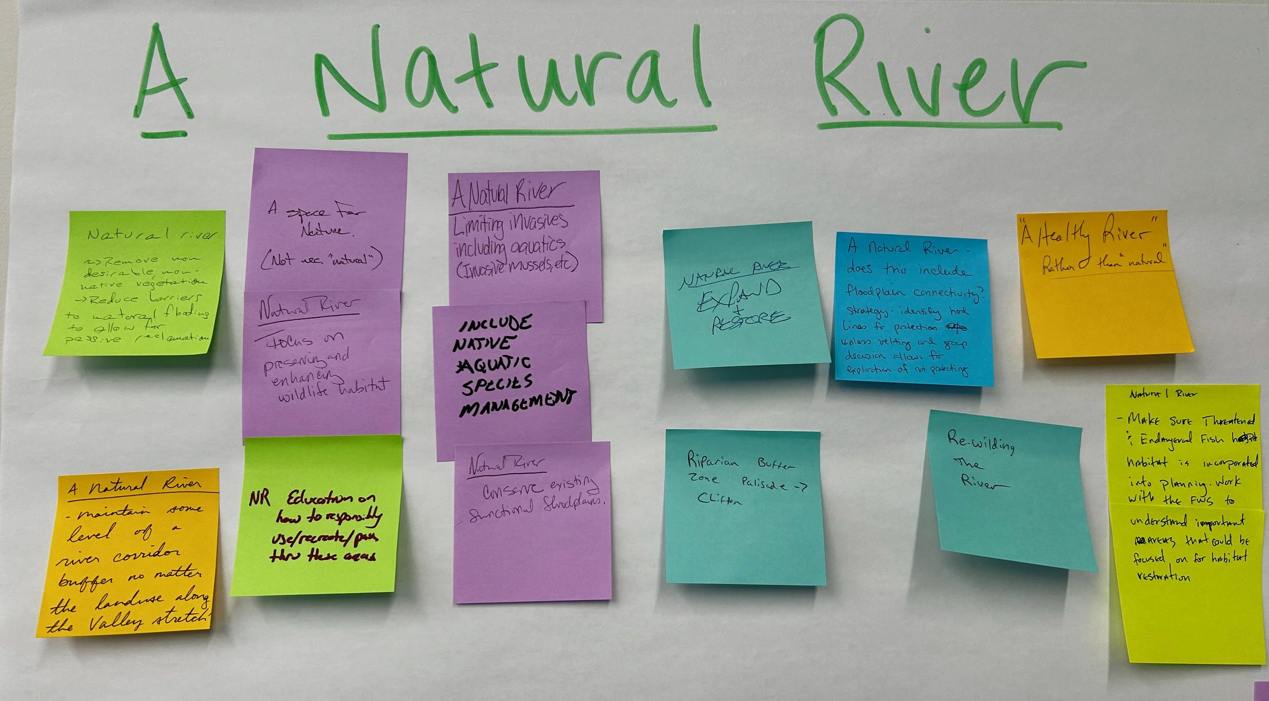
Promote a Healthy River
Protect riparian health to support long-term ecological function and resilience
Support a Prosperous Community
Guide development along the river’s edge to support economic vitality
Ensure a Sustainable Recreational Asset
Thoughtfully manage active and passive recreation
Promote a Connected Corridor
Improve access to the river and connectivity along the river
Increase Community Awareness
Educate the community to be good stewards of the river
eNGAGeMENT:
Phase 1: Discovery (Fall/Winter 2025)
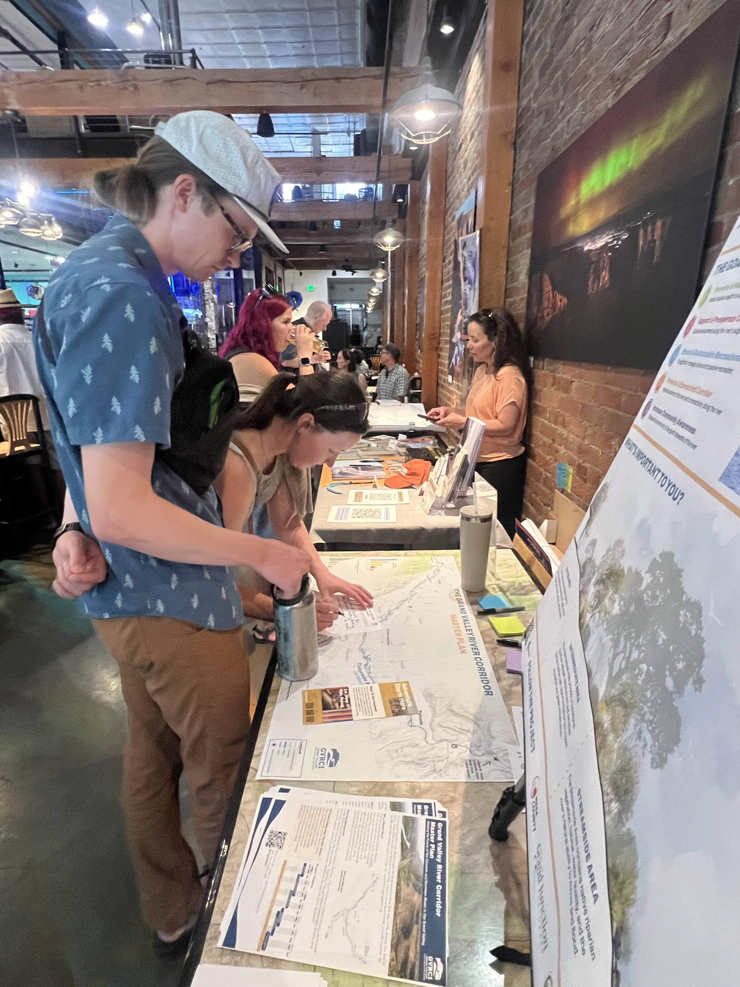
During this phase, the project team engaged with more than 300 community members from September to December 2025 to learn initial priorities and goals, through an online survey, individual stakeholder interviews, and outreach at the 2025 APA Colorado Conference and the 2025 GVRCI West Slope Outdoor Recreation Industry Summit.
We heard a strong desire for a balanced approach to the river’s edge, recognizing the Colorado and Gunnison Rivers as central to the Grand Valley’s identity, recreation economy, and quality of life. Community members, stakeholders, and property owners consistently supported improving river access, trail connectivity, and recreation opportunities while emphasizing the need to protect habitat, agricultural lands, cultural resources, water systems, and overall river stewardship through coordinated, equitable, and sustainable planning.
Phase 2: Plan Development (Spring 2026)
During this phase, the project team consulted with resources specialists, river-related subcommittees, and planning representatives from each jurisdiction to confirm and collect detailed feedback on preliminary Master Plan elements.
Phase 3: Finalizing the Plan (Summer/Fall 2026)
The team is kicking off this phase by attending the River Talk from the Groover: Stories, Stewardship & Season Prep, hosted by the Grand Valley Outdoor Recreation Coalition on May 12th.
Stay tuned for summer engagement opportunities in your community!
DIScovery Phase
As a first step in the Master Planning process, the team developed a data-driven approach to better understand how the river corridor currently functions.
Learn more below!
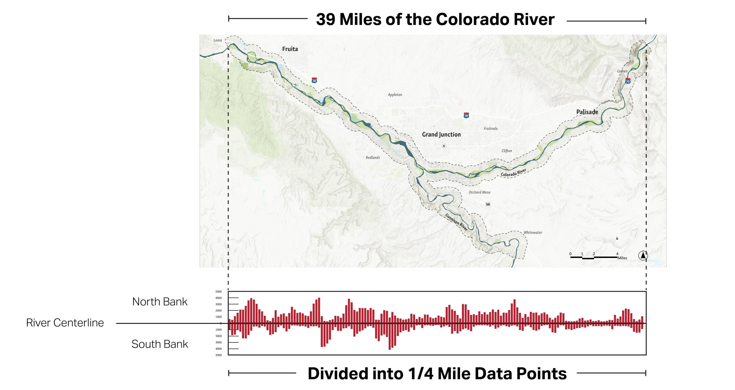
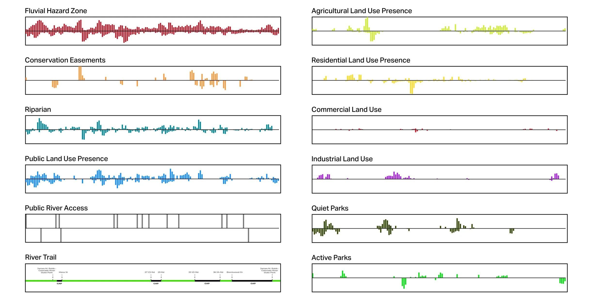
Part 1
The Discovery Phase divided the Colorado and Gunnison Rivers into quarter-mile segments and evaluated key features within the Fluvial Hazard Zone. In the discovery charts, information north of the river centerline is displayed at the top of each chart, while information south of the river centerline is shown below.
The Fluvial Hazard Zone was selected as the study boundary because it captures the full area the river has historically occupied, may occupy in the future, or can physically influence through the movement and storage of water, sediment, and debris. By defining the river corridor through its natural processes rather than fixed channel boundaries, the Fluvial Hazard Zone provides a more comprehensive understanding of where river dynamics, flood hazards, habitat, infrastructure, land use, and long-term stewardship priorities converge.
Part 2
Using these quarter-mile segments, the project team evaluated river corridor conditions related to land use, riparian habitat, conservation easements, the Riverfront Trail, public river access, and various park types. Together, these datasets provide a comprehensive picture of how people use and interact with the corridor, while also identifying where critical land uses, recreational assets, ecological resources, and conservation priorities are concentrated.
Part 3
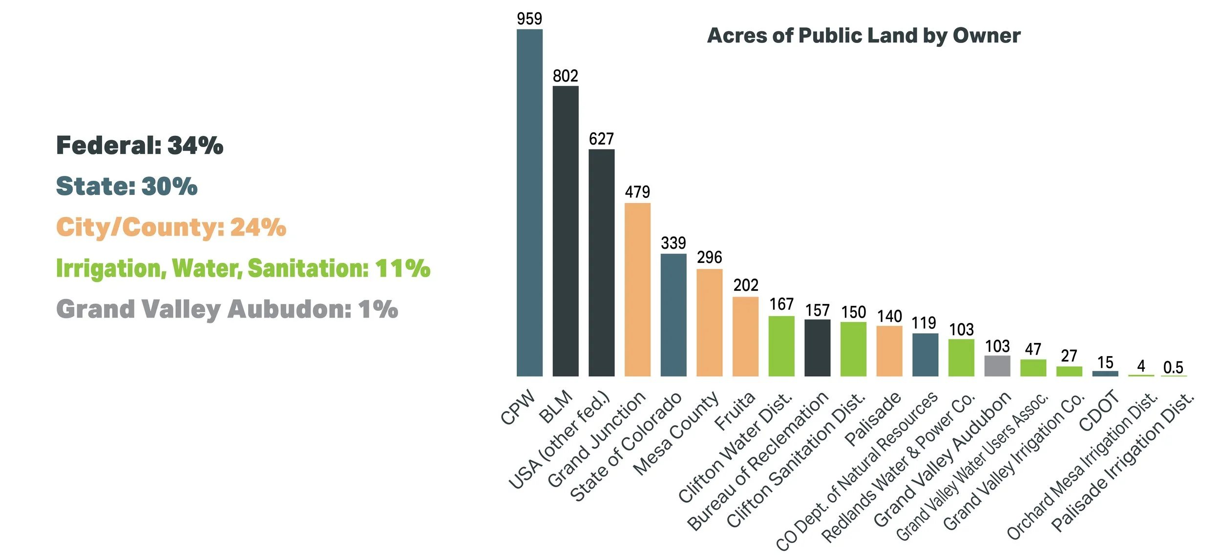
Public land is the dominant land use within the Fluvial Hazard Zone, accounting for 37% of the study area. Agricultural land represents 23%, followed by residential land at 13%, industrial land at 6%, and commercial land at 2%.
The next part of the analysis examines public land ownership and management in greater detail to better understand stewardship responsibilities, coordination opportunities, and long-term management priorities. In total, the corridor contains more than 4,700 acres of public land managed by 16 different public entities.

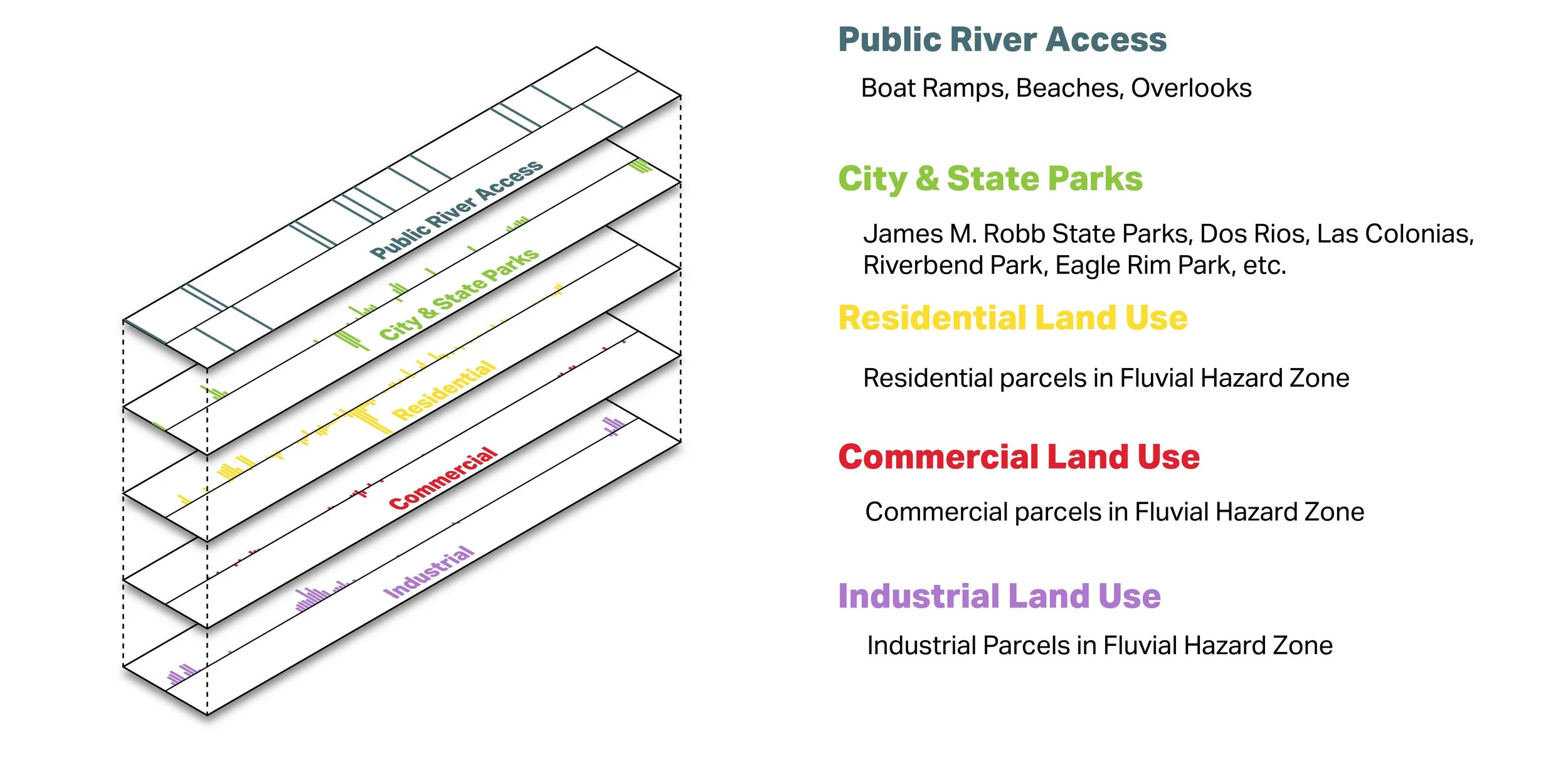
Part 4
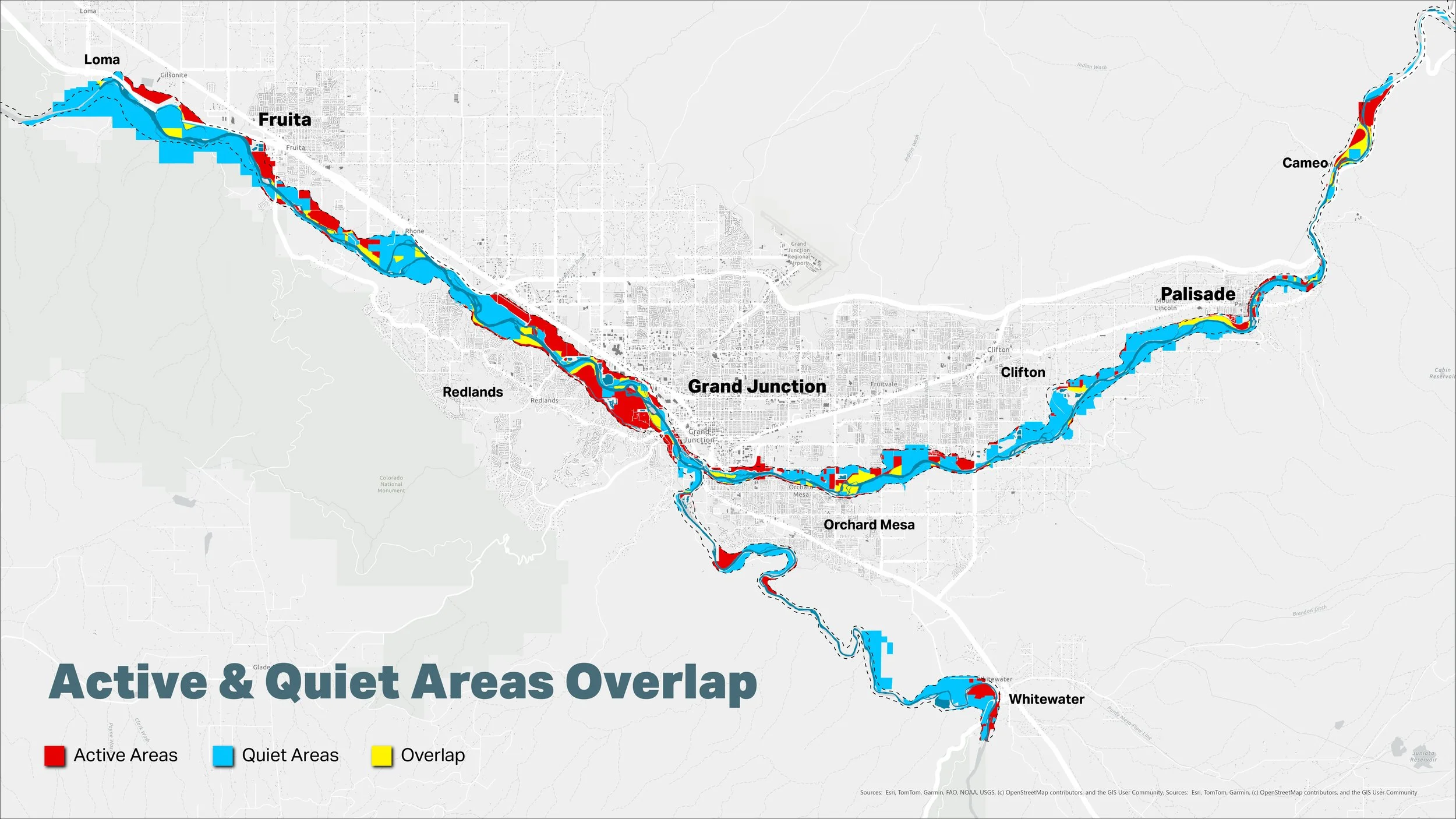
The data was then layered to identify “active” and “quiet” areas along the corridor.
Active areas were defined by the concentration of higher-intensity human activity and recreation, including public river access points, city and state parks, and residential, commercial, and industrial land uses.
Quiet areas were defined by combining places that are more closely tied to conservation, habitat, wildlife, and working landscapes, including conservation easements, state wildlife areas, riparian habitat, and agricultural land use.
Active Areas
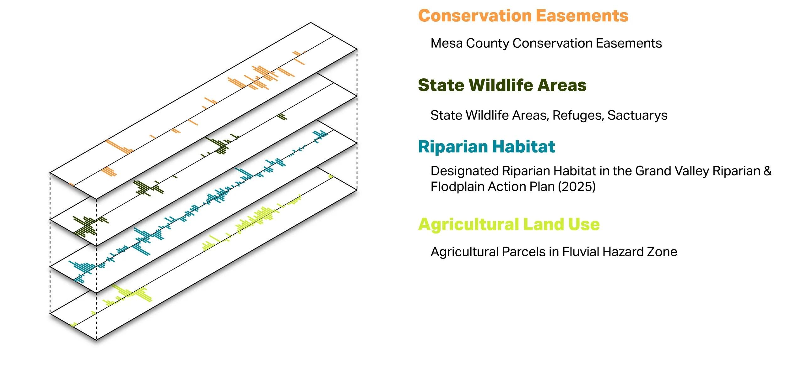
Quiet Areas
Part 5
The final discovery map brings these layers together by identifying active areas, quiet areas, and locations where these conditions overlap throughout the corridor. As the culmination of the Discovery Phase, the map provides a comprehensive snapshot of the river corridor today and establishes a shared framework for understanding its many functions, values, and challenges.